Dew point temperature is critical in assessing frost risk because it indicates the temperature at which air becomes saturated and moisture condenses, leading to frost formation when the air temperature drops to or below this point. Monitoring the difference between air temperature and dew point temperature helps predict frost events by revealing how close conditions are to saturation and potential ice formation on crops. Accurate forecasting of these temperatures enables farmers to implement timely protective measures, minimizing damage and ensuring crop health.
Table of Comparison
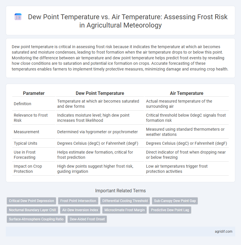
| Parameter | Dew Point Temperature | Air Temperature |
|---|---|---|
| Definition | Temperature at which air becomes saturated and dew forms | Actual measured temperature of the surrounding air |
| Relevance to Frost Risk | Indicates moisture level; high dew point increases frost likelihood | Critical threshold below 0degC signals frost formation risk |
| Measurement | Determined via hygrometer or psychrometer | Measured using standard thermometers or weather stations |
| Typical Units | Degrees Celsius (degC) or Fahrenheit (degF) | Degrees Celsius (degC) or Fahrenheit (degF) |
| Use in Frost Forecasting | Helps estimate dew formation, critical for frost prediction | Direct indicator of frost when dropping near or below freezing |
| Impact on Crop Protection | High dew points suggest higher frost risk, guiding irrigation | Low air temperatures trigger frost protection activities |
Understanding Dew Point Temperature in Agriculture
Dew point temperature is a critical parameter for assessing frost risk in agriculture, as it represents the temperature at which air becomes saturated and water vapor condenses. When the air temperature approaches or falls below the dew point, frost formation is highly likely, potentially damaging sensitive crops. Monitoring the dew point alongside air temperature enables farmers to implement timely frost protection strategies and minimize agricultural losses.
Air Temperature: Definition and Importance
Air temperature, the measure of heat energy in the atmosphere, is crucial for assessing frost risk in agricultural meteorology. It directly influences plant physiological processes and the likelihood of frost formation, which can damage crops during critical growth stages. Accurate air temperature monitoring helps farmers implement timely frost protection measures to safeguard yields.
How Dew Point and Air Temperature Interact
Dew point temperature and air temperature interaction critically influences frost risk by determining moisture condensation and ice formation on crops. When air temperature approaches the dew point, the likelihood of dew or frost formation increases, especially if the dew point is near or below freezing. Understanding this relationship helps predict frost events, allowing farmers to implement protective measures to minimize crop damage.
The Science of Frost Formation
Dew point temperature and air temperature critically influence frost formation by determining the saturation level of water vapor in the air. When the air temperature drops to or below the dew point, condensation occurs, leading to the formation of frost if temperatures fall below 0degC. Understanding the relationship between these temperatures helps farmers predict frost risk and implement timely protective measures for crops.
Dew Point as a Predictor of Frost Risk
Dew point temperature serves as a critical predictor of frost risk by indicating the temperature at which air moisture condenses and freezes on crops. When air temperature approaches or falls below the dew point, the likelihood of frost formation increases significantly, posing a threat to sensitive agricultural plants. Monitoring dew point thresholds allows farmers to implement timely frost protection measures, optimizing crop yield and minimizing damage.
Air Temperature Thresholds for Frost Events
Air temperature thresholds for frost events typically range between 0degC and 2degC, with dew point temperature playing a critical role in determining frost risk by indicating the moisture content in the air. When the air temperature drops to or below the dew point, water vapor condenses and potentially forms frost, especially if the dew point is near or below freezing. Monitoring both air temperature and dew point provides essential data for predicting and mitigating crop damage from frost in agricultural meteorology.
Monitoring Dew Point and Air Temperature for Crop Protection
Monitoring dew point temperature alongside air temperature is critical in agricultural meteorology to assess frost risk accurately and protect crops from potential damage. When air temperature approaches the dew point, condensation forms, increasing the likelihood of frost, which can harm sensitive plants during vulnerable growth stages. Implementing precise sensors and real-time data analysis enables timely frost warnings and effective frost mitigation strategies such as irrigation or wind machines.
Tools and Technologies for Measuring Dew Point and Air Temperature
Accurate measurement of dew point temperature and air temperature is critical for assessing frost risk in agricultural meteorology, utilizing advanced tools such as chilled mirror hygrometers and digital psychrometers for precise dew point detection. Automated weather stations integrate thermistors and capacitive sensors to continuously monitor air temperature, enabling real-time frost prediction and microclimate analysis. Remote sensing technologies combined with IoT-enabled field sensors enhance spatial resolution, providing granular data to optimize frost mitigation strategies in crop management.
Best Practices to Mitigate Frost Risk Based on Meteorological Data
Monitoring the dew point temperature alongside air temperature enables accurate prediction of frost risk by identifying conditions where temperatures approach or drop below freezing. Implementing frost mitigation practices such as using wind machines, targeted irrigation, or row covers based on real-time meteorological data minimizes crop damage. Consistent analysis of temperature trends and dew point fluctuations allows for timely interventions, optimizing agricultural productivity and reducing economic losses.
Case Studies: Frost Incidents and Meteorological Insights
Dew point temperature closely approaching or equaling air temperature indicates high humidity and a greater likelihood of frost formation during clear, calm nights in agricultural regions. Case studies in temperate zones reveal that frost incidents often occur when air temperature drops below 2degC above the dew point, signaling radiative cooling and surface temperature reaching freezing levels. Meteorological insights from these studies emphasize the importance of continuous monitoring of dew point and air temperatures to implement timely frost mitigation strategies, reducing crop damage.
Related Important Terms
Critical Dew Point Depression
Critical Dew Point Depression, defined as the temperature difference between air temperature and dew point temperature, is a key parameter in agricultural meteorology for assessing frost risk. When this depression is small, indicating air temperature near the dew point, there is increased likelihood of frost formation, which can severely damage sensitive crops.
Frost Point Intersection
The frost point intersection occurs when the dew point temperature meets or drops below the air temperature, indicating a high risk of frost formation critical for crop protection strategies. Monitoring this intersection enables precise prediction of frost events, allowing farmers to implement timely frost mitigation measures in vulnerable agricultural zones.
Differential Cooling Threshold
Dew point temperature and air temperature critically influence frost risk assessment in agricultural meteorology, with the differential cooling threshold serving as a key parameter to predict frost occurrence by identifying the temperature gap where surface cooling leads to frost formation. Accurate monitoring of this threshold helps farmers implement timely frost protection measures, minimizing crop damage and optimizing yield.
Sub-Canopy Dew Point Gap
The sub-canopy dew point gap, defined as the difference between dew point temperature and air temperature beneath crop foliage, serves as a critical indicator for frost risk during agricultural meteorology assessments. A smaller gap often signals higher humidity and increased frost occurrence probability, enabling precise microclimate management strategies to protect sensitive crops.
Nocturnal Boundary Layer Chill
Nocturnal boundary layer chill significantly influences frost risk by causing the dew point temperature to approach or fall below the air temperature, leading to condensation and ice formation on crops. Monitoring the vertical temperature gradient within this layer aids in predicting frost events and implementing timely frost protection strategies in agricultural meteorology.
Air-Dew Inversion Index
The Air-Dew Inversion Index (ADII) quantifies the temperature differential between air temperature and dew point temperature to assess frost risk in agricultural meteorology. A lower or negative ADII indicates a higher likelihood of frost formation, signaling critical conditions for crop protection measures.
Microclimate Frost Margin
The dew point temperature and air temperature relationship critically influences microclimate frost margins by indicating when surface cooling can lead to frost formation. Monitoring the gap between dew point and air temperature helps predict frost risk zones, as smaller differences increase the likelihood of ice nucleation on crops within microclimates.
Predictive Dew Point Lag
Predictive dew point lag refers to the delayed response of dew point temperature compared to air temperature changes, which significantly affects frost risk forecasting in agricultural meteorology. Accurately accounting for this lag enhances the precision of frost occurrence predictions by improving the timing estimates when air temperature approaches the dew point, critical for crop protection strategies.
Surface-Atmosphere Coupling Ratio
The Surface-Atmosphere Coupling Ratio quantifies the relationship between dew point temperature and air temperature in assessing frost risk, with values closer to one indicating stronger coupling and a higher probability of frost occurrence. Monitoring this ratio helps optimize frost forecasts by revealing the extent to which surface cooling affects near-surface air, critical for timely agricultural interventions.
Dew-Aided Frost Onset
Dew point temperature closely approaching air temperature indicates high humidity levels that facilitate dew formation, which slightly raises surface temperature and delays frost onset, reducing frost risk in crops. Monitoring the dew point-air temperature difference is essential for predicting dew-aided frost onset and implementing timely frost protection strategies in agricultural meteorology.
Dew Point Temperature vs Air Temperature for frost risk Infographic